Scars, Beads, and Braids The Nyangatom are one of the many unique ethnic groups living in Ethiopia’s Omo Valley. Both men and women practice scarification for decoration. A woman’s age and status can be determined by the weight and quality of her beads: she gets her first strand from her father, and adds more every year.
Some trips produce such a maelstrom of impressions and images that, when reviewing the photos, it makes sense to start at the end.
So it was with Ethiopia!
The first photo-stories I posted about this landlocked country, split by the Great Rift Valley, were from the last tribe I visited, the Mursi people, whose villages are deep in the wild territory between the Mago and Omo Rivers (see: Mursi Portraits).
This current post, the last of the sets from the Ethiopia’s Omo Valley, takes place further south: on the western side of the Omo River, bordering South Sudan. This is now the domain of the Nyangatom, a Nilo-Saharan group thought to have migrated there from northern Uganda in the mid-late 19th century.
Being a visitor to these remoter areas of the world always raises dilemmas. I’ve seen photographers ask subjects to remove their shirts, remove their shoes, and hide their mobile phones: some people expect ‘traditional’ culture to be ‘static’.
Which, of course, it isn’t.
Even without the the encroachment of the modern world, culture changes. As an outsider, it is impossible to know how to balance the social benefits of traditional tribal life against the hardships, the regimented structures, the lack of education and choice, and the low life expectancy inherent in these subsistence-lifestyle communities.
In this region, the building and expansion of the Gibe III Dam on the Lower Omo has had – and continues to have – life changing consequences for all the ethnic groups along the river (q.v.: Mongabay Series; The Conversation; and Survival International). The dam is a hydro-electric boon to the whole country, and an irrigation gift to local sugar producers. But, it is all but destroying the flood-retreat agriculture that traditional ethnic groups depend on and have been practicing for generations.
I was travelling with a small group of photography enthusiasts on a Piper Mackay tour lead by photographer Ben McRae. From Addis Ababa we had flown into Arba Minch, the second largest town in the rather-clumsily named Southern Nations, Nationalities, and Peoples Region of Ethiopia. From there, days of bumping along in four-wheel drives along highways, dirt roads, and jungle tracks, gave us access to a number of the unique ethnic groups along the Omo River (see: Omo Valley).
Somehow, it seems appropriate, that on our last day in the country, while we drove to the Jinka Airport – little more than a stretch of runway and an over-sized tin shed in a grassy field – to return to Addis Ababa, baboons showed us their bottoms with contempt as they retreated to the scrub.
And, the last image I took along the road was of a truck full of soldiers with their rifles pointed willy-nilly, off to protect – not people – but the sugar from the local factories.
Certainly, a kaleidoscope of mixed impressions!
The Nyangatom were the penultimate group we spent time with. I’ve described some of their customs previously (see: Dark Eyes and Layers of Beads). Let’s revisit them before their ways disappear – along with the receding river.
High, Hot, and Dry The Nyangatom side of the Omo River sits on a high plateau over the running waters below.
Goat in the Kraal The homes in the settlement are surrounded by a thorn-bush fence – which includes areas for the cattle and other animals, and which is opened up in the daytime.
Young Nyangatom Man These small ethnic groups in the Omo Valley have very little to sell, but they have learned that their appearance is marketable to tourists. In most places, we had to barter on the ‘Pay per Click’ model. This includes paying for pictures of people’s homes and livestock. In this instance, however, we paid a fixed price for the whole village. This gave me much more freedom to wander, and my interactions with people felt more natural.
Nyangatom Woman in Brown Beads I’ve shared pictures of this lovely Nyangatom woman before. Women wear up to 8 kg (17 lb) of beads, which they don’t take off.
Woman in Red, White, and Blue The material used in the small lip plugs worn by both men and women can be determined by status. Elder women wear copper, and elder men wear ivory.
A Calabash and a Mobile All across the Omo Valley, calabash gourds are hollowed out and dried, and used as drinking utensils or for carrying water.
Man in Green Men all carry their wooden stools, so unlike the women, they don’t sit directly on the ground.
Colourful Beads and a Headdress The keys on this woman’s necklaces look too clean to be purely decorative; I don’t know what they lock/unlock.
In a Nyangatom Courtyard Nyangatom men are polygamous, and their wives all have their own woven beehive huts within the village compound.
Kids in the Courtyard Children are everywhere.
Young Man in Colourful Blanket Mornings are cool – even here in the Tropic of Capricorn – and people wrap themselves in whatever they have.
Arm Decorations Both men and women practice scarification for decoration. Thorns or razors are used to cut the skin, and ash is rubbed into the wounds to create the raised scars.
Smiling Lad
Nyangatom Elder in Green These faces could tell some stories …
Smiles of an Elder … and the smiles are infectious – even without a shared language.
Can you Read his T-Shirt? Men all carry their walking sticks and stools with them. I have no idea what the Ethiopian text on this t-shirt says; chances are, this elder doesn’t either!
Beads and Beauty-Scars
Beauty-Scars, Beads, and a Baby
Men with Automatics Territorial warfare and cattle theft are very real problems in this region: young men here are expected to be well armed, and most have AK-47s left over from the civil war in neighbouring (South) Sudan.
Elder in Tattoos When men kill an enemy, they cut patterns into their shoulders and chest to release any bad spirits.
Village Tableau Nyangatom bee-hive huts are dark inside, with low doorways and no windows.
Young Man
Donkeys on the Horizon Nyangatom are semi-nomadic, and keep donkeys to help with transport when they move their settlement to follow their cattle and goat herds.
Omo River Waterfront The river is the lifeblood for these people. As we were leaving the village in our outboard boat, we watched herds of zebu cattle being guided down to the water’s edge to drink.
Goats in the Road Livestock are how many Africans measure their wealth. The next day, on our drive out of the National Parks towards Jinka, we had to wait for a herd of goats crossing the dusty main road.
Ethiopia is hot, and dusty, and dirty, and – like the rest of Africa – it gets into your blood; as soon as I had landed home after transiting what has to be one of the world’s worst international terminals, I was trying to figure out how I could go back.
Rocky Outcrop The views over the Sapphire Coast from the Bermagui Coast Walk in the far south of New South Wales on a sunny spring day are breathtaking.
If you are going to be locked in your own region because of Covid-19 border controls, it helps to have a magnificent back yard!
For most of the past almost-two years, those of us in Australia – like people in much of the rest of the world – have been under some level of travel restriction. Part of this period, I couldn’t venture further than five kilometres from home, and even then only for ‘essential purposes’.
Fortunately, I live in a beautiful area, and unlike last year, this year we weren’t hampered by raging bush fires. There were windows of opportunity when the boundaries expanded slightly, and I took advantage of those when I could.
Back in July, the walking group of my regional branch of the National Parks Association was able to meet up – in a Socially-Distanced manner, of course – for a short walk in Ben Boyd National Park, which is literally on my doorstep.
I’ve done this walk before (see: In the Aussie Bush), but what amazes me when I looked back over the pictures from both visits, is how many differences there were in what caught my attention. Both times I’ve done this undulating 6 kilometre (return) walk, we started at Haycock Point picnic area, had our picnic lunches on Barmouth Beach, and then returned.
Roos in the Grass On a flat area just north of our starting spot at the Haycock Point picnic area, a couple of eastern grey kangaroos (macropus giganteus) are resting in the grass.
Haystack Rock Haycock Point gives us views over the rock platform to the dome-shaped Haystack Rock. The iron-oxide that colours these red, riverine rocks is a relic of the atmospheric oxygen from the Devonian Age.
Colours of the Sapphire Coast The variations of the blues in the waters are impressive against the layers of colour in the rocky coast.
Colourful Lichens and Tumbled Rock The fungus on the boulders, and the shrubs on cliff face, are a veritable patchwork of hues and textures.
New Holland Honeyeater – Phylidonyris Novaehollandiae
The Jagged Shore From the cliff tops, a break in the heath, banksia, and gum trees, allows us views back over the coast to Haystack Rock. The SS Empire Gladstone survived World War II only to ground – without loss of life, fortunately – on the rocks on the south side of this spit in 1950. The sunken ship is now a popular dive site.
Arched Rock Lookout Shortly, we come to another break in the overgrowth, where we have views over an unnamed arch of rock.
The Unnamed Arch This unusual rock arch is just one of the many craggy sculptures created by the eroding forces of the ocean.
Pambula Beyond Around the next bend, the colours of the water deepen at the mouth of the Pambula River, and parts of the small town of the same name come into view.
Red Rocks on Barmouth Beach Below
Silver Gull – Chroicocephalus Novaehollandiae A hopeful gull watches us as we lunch.
After lunch on the beach, we walked back the way we had come …
Some months later, in spring – and after another lockdown spell – I had the opportunity to do a walk that I had always promised myself: overlooking the Horse Head Rock near Wallaga Lake.
My walking companion and I started with a late lunch in Bermagui before driving a short way north and parking the car at Hayward Point. From there, we picked up the walking track that follows the old Tilba Road. In spite of being unpaved until 1963, this was the main road into Bermagui from the north-south Princes Highway. It threaded its way between the Long Swamp Nature Reserve and the Pacific Ocean. Sections of the road washed away in the 1970s, before it finally became a cycle- and waking-track.
Bermagui to the South We start our walk at Hayward Point, where we can look south over the beach to the little coastal town of Bermagui …
North from Hayward Point … and north along the empty sandy coastline.
Long Swamp Flora and Fauna Reserve After walking a short way, we are on a slight ridge with water on both sides: Hayward Beach drops down to Horseshoe Bay and the Pacific Ocean on the right, and Long Swamp stretches out along the left.
Coastal Banksia – Banksia Integrifolia
Pig Face Yellow – Lampranthus Glaucus When we come back into the open, pig face – or ice flowers – are defending the sands from erosion.
Branching Trees The path leads us under the trees, …
Camel Rock … and back to the cliffs overlooking the aptly-named Camel Rock.
Rocks on the Sapphire Coast Even the unnamed rocks are pretty impressive!
Daisies on the Path
Horse Head Rock The next feature is the one I have been waiting for: Horse Head Rock, which is believed to be approximately 500 million years old!
Sandbar and Wallaga Lake Our walking path ends near Murunna Point, where we admire the sand bar that keeps Wallaga Lake separated from the Pacific Ocean …
White-Bellied Sea Eagle – Haliaeetus Leucogaster … and a white-bellied sea-eagle circles overhead. Raptors always get my attention, and although I never get ‘the shot’ I want, I love watching them soar.
Cobargo-Bermagui Road As stunning as the coastal walks are, driving home through the verdant fields is just as beautiful! (iPhone12Pro)
Wherever you have found yourself in this strange andlocked-down world, I hope you have some natural beauty to comfort you, and blue skies overhead.
Looking into Bryggen Laneways The old streets of Bergen’s Hanseatic Wharf district are narrow, cobbled, and winding – and busy with visitors exploring Bryggen‘s history and shops.
It was raining.
But that didn’t stop the residents of Bergen, Norway’s second-largest city, from coming out into the streets and public spaces to celebrate their cultural heritage. I was very lucky with the Sunday I had by myself exploring the delightful city: a local troupe was performing traditional folk dances under the protective roof of the central railway station, and the Buekorps – the Bow Corps or Archery Brigade – were marching through the city.
The Buekorps is a peculiarly Norwegian concept that was once active across other cities, but is now unique to Bergen. The tradition dates back to the 18th century when local boys would imitate the adult militia soldiers performing close-order drills. By the 1850s, the boys had organised themselves into bataljoner (battalions) and built their own “fortresses” from which to engage in “warfare” against children from other neighbourhoods. Today, members range in age from about 7 to 20, with the first girls being admitted in 1991. On special days during spring – especially on May 17th, Norwegian Constitution Day – the children march through the streets with wooden guns, swords, and drums.
Even away from the dancers and the marching children, the streets of this UNESCO World Heritage City and European City of Culture were a delight to explore. I had gained an overview of some of the surrounding hills the day before (see: Overlooking Bergen), so I was looking forward to wandering the steep cobbled streets at my own pace.
Do join me!
Little Girls in Costume I was lucky: my hotel was near the train station, and when I went in to check it out (and to escape the rain), some delightful Norwegian children in their plaits and embroidered reindeer boots were waiting to dance.
Enthusiasm! The enthusiasm of these little girls, as they performed their traditional folk dances with their teacher, was infectious!
Children’s Folk Dancing Circle
Portrait of a Folk Dancer The next group to perform were women, with flower wreaths on their heads, …
Swirling Skirts … and with plaited hair and long skirts flying.
Folk Dancers High kicks featured, …
Dancer in a Red Bodice … as did a joyful attitude.
The Dancing Suitor This was a couple’s dance, but the woman and man did a solo turn …
Joyful Couple … before joining together in a cheerful and lively pantomime.
Street Art I left the shelter of the station to climb a hill through the old city – where I came upon my first fearsome troll of the day. Trolls are a feature of Scandinavian folklore and Old Norse mythology. They live in isolated rocks, mountains, or caves… and on the sides of some Bergen buildings.
Steep Streets The cobbled streets are steep and narrow as they wind and zig-zag up the hillside.
Johanneskirken Standing Tall The views back down over the city make the climb worth it. The red brick Gothic-revival St. John’s Church, built in 1894, stands out below.
St. Paul’s Church and Bergen Harbour Colourful walls and rooftops lift any gloom from the lowering sky …
Knitted Trees … and knitted skirts around some of the trees are positively cheerful.
Over Bergen Rooftops From another vantage point, we can see Christi Krybbe Skoler, the oldest existing elementary school in Scandinavia, and the two towers of the oldest existing building in Bergen: Mariakirken (St Mary’s Church), built in the 12th century.
Skansen Brannstasjon Inspired by 17th- and 18th-century panel architecture, the old Skansen fire station was actually opened in late 1903.
Bergen Harbour from Above
Cobbled Pathways I work my way back down the hill using cobbled pathways between tall buildings.
Øvre Blekeveien and Ole Eides Gate
Spring Magnolias Magnolia blooms signal spring.
Audun Hetland (1920 – 1998) A bust in a street near Bryggen celebrates a Bergen-born Norwegian illustrator.
Rainy Courtyard When I get back down to the courtyard outside St. Marys Church, light rains have settled in again.
Mariakirken The Romanesque-style St. Mary’s Church is a basilica-shaped stone church with two towers. The oldest remaining building in Bergen, it was started in the 1130s and finished some time before 1250.
St. Mary’s Church Door The German merchants during the Hanseatic era (1356 – 1862) used this church, leading it to be called the “the German church” (Tyskekirken).
St. Mary’s Church Door Latch
Tyskebryggen – “German Bryggen” Narrow old wooden walkways wind through the UNESCO heritage-listedHanseatic commercial buildings in Bryggen. They are slippery when wet – and a fire-hazard when dry.
3 Kroneren Pølsebu It was well past lunch time when I got back to the centre of the old town, but this historic sausage shop was still doing a brisk trade. In operation since 1948, the ‘three kroner’ sausages have gone up since then. There is a huge selection of international treats to chose from, but when in Norway... I had the reindeer sausage with loganberry – and it was delicious!
Youths of the Buekorps By early afternoon, groups of uniformed and ‘armed’ youths were walking into the city centre to form their battalions.
Portrait of Young Buekorps Boys Each troupe has their own colours and insignia. Some of the children look very young!
Back Lanes It’s the everyday sites that attract my eye: like this child’s bicycle in a graffitied laneway.
St. Jorgens Hospital St. Jørgen’s Hospital, one of Scandinavia’s oldest hospital complexes, was established in the early 1400’s. This well-preserved building was built in the 18th-century and was a residential treatment facility for people with leprosy from the 1870’s until the death of the last two residents in 1946.
Museum Lepramuseet The Leprosy Museum was established in 1970 in this hospital complex. The museum recognises the thousands of people who suffered from the illness in Norway. Bergen-born Norwegian physician Gerhard Armauer Hansen (1841 – 1912) discovered the bacterial cause of leprosy, the Mycobacterium leprae, in 1873. This lead to better treatments and ultimately a vaccine and a cure.
Buekorps in the Street Back in my room in the late afternoon, I can see the drummers, still marching in the wet street below.
Koselig or Hygge Downstairs in the dim dining room, I am met with shining glassware on tables set with candles and flowers, and chairs draped in comforting sheepskins: the kind of scene that invites the warm cozy feeling that the Norwegians call koselig, and the Danish introduced to the world as hygge. (iPhone6)
The Danish word hygge comes from a sixteenth-century Norwegian term, hugga, meaning “to comfort” or “to console,” and is related to the English word “hug.”
That dining room – and a wonderful meal – chased away any chill remaining from being out in the wet streets, and was a fitting end to a lovely couple of days exploring Bergen.
Temple of Ramesses II – Abu Simbel Visitors are dwarfed by the 20-metre (65 foot) seated Colossi that the Pharaoh Ramesses II had built in his own honour.
The archaeological remains and artefacts that survive to attest to the richness of the almost 30 centuries of civilisation we now call Ancient Egypt (3100-333 BC ) are mind-boggling.
That people between 3000 and 5000 years ago conceived of – and built – the pyramids, tombs, mausoleums, and temples, that scatter along the Nile amazes me. That they built them so well that these structures endure for us to explore and enjoy today is just astonishing!
I was awestruck by each and every archaeological site, but one of my favourites was at Abu Simbel.
Abu Simbel sits 280 kilometres south of Aswan, in what is now the Aswan Governorate of Upper Egypt. During the rule of Pharaoh Ramesses II (1303-1213 BC) – also known as Rameses and Ramses – this was Nubia, and the southern limit of Egyptian control at the time. Ramesses II is often regarded as the greatest pharaoh of the Ancient Egypt’s New Kingdom (1570- c. 1069 BCE). He built a number of temples to impress and intimidate his trading partners and enemies, and to memorialise and deify himself: the most prominent of these are the two temples at Abu Simbel.
The rock-cut temples were originally constructed over three thousand years ago, between 1264 and 1244 BC. The larger of the two, the Great Temple, was dedicated to Ramesses II himself, and the Small Temple, also known as the Temple of Hathor, was dedicated to his chief wife Queen Nefertari. As impressive as these are, over time they fell into disuse. They were almost completely buried in sand when they were rediscovered in 1813. The story goes that a Swiss explorer was led to the site by an Egyptian-Nubian boy called Abu Simbel. By 1909, the sand had been removed, and the site became a popular attraction.
Then, with the building of the world’s largest embankment dam, the 4,000 metres (13,000 ft) long Aswan High Dam – between 1960 and 1970 – the temples were at risk of being lost under the rising waters of Lake Nasser. The Egyptian Government, with the assistance of UNESCO, managed to source international funding to rescue these two temples and the Temple Complex at Philae (see: The Sacred Temple of Isis). Between 1964 and 1968 the Abu Simbel temples were cut into 20 to 30 ton sections, moved and reassembled in the current location which is an artificial cliff 210 m (688ft) back from and 65 m (213 ft) above their original position, and then surrounded by an artificial stone mountain. Getting the orientation right was critical, because the temples were aligned to allow the rising or setting sun to reach the central chamber on the anniversaries of Ramesses II’s ascension to the throne and on his birthday.
Although it is possible to drive the 300 km (168 mile) from Aswan to Abu Simbel, we took an early morning 30-minute flight to the nearby small airport: to my mind, this made the whole trip even more exotic.
It truly is a marvel worth visiting!
Can you Feel the Heat? Aswan is known for its hot desert climate. It is just after ten o’clock on an October morning: the sun is high in a cloudless sky, and heat radiates from the unshaded sandy terrain.
Great Temple of Rameses II As you round the bend, the front of the temple commands the scene. Standing at 33 metres (108 feet) high and 38 metres (125 feet) wide, the Great Temple dwarfs the visitors in the forecourt.
The Temple of Hathor – The Small Temple The nearby temple dedicated to the the Nubian Queen Nefertari, the favourite wife of Rameses II, has six 10-metre (33 foot) statues standing in niches across the front.
Outside the Small Temple Each side of the temple doorway a carved relief of Queen Nefertari is flanked by two statues of Rameses II. It is unusual in Egyptian art for pharaohs to be depicted in the same scale as their wives – and is further demonstration of his esteem for her.
Ramesses II outside the Small Temple In spite of the passage of time, there is a rough-hewn beauty to the original sandstone the temples were carved into.
Hypostyle Hall – The Temple of Hathor The logic escapes me: I could take photos with my phone quite freely inside the temples – but not with my cameras. (iPhone6)
Hathor Column: Hypostyle Hall
Tourists, Columns, and Art
Wall Art Inside the Nefertari Temple Anyone who knows how to ‘read’ these stories could spend hour in here: I just admired the designs and colours. (iPhone6)
Visitors to the Site Back outside in the heat and glare, it’s a short walk between temple entrances.
Great Temple The four seated 20-metre (65 foot) Colossi of Ramesses II are imposing as you approach them.
Temple of Ramesses II The reconstruction and renovation allows a sense of ‘age’ as well as timelessness.
Horus The temple was originally built by Ramesses II to commemorate his victory at the Battle of Kadesh (1274 BC), and is dedicated to the himself and the ancient Egyptian Gods of Amon, Ra, and Ptah. Here, Horus wears the solar disk of the God Ra.
Mut-Tuy and Graffiti At the feet of the Colossi, small figures of members of the Pharaoh’s family. I think this worn figure is the mother of Rameses II.
Queen Nefertari – Left Tucked under the Pharaoh’s knees on either side of the entry, …
Queen Nefertari – Right … the favourite wife stands like mirror images.
Horus and Hieroglyphs
Ramesses II There is a modern, minimalist, beauty in these ancient figures.
Hypostyle Hall Inside the Grand Temple, beautiful Osirian columns represent Ramesses in his deified form. (iPhone6)
Inner Sanctuary : House of the Gods At the heart of the temple, Ramesses II, Ptah (God of creation), Amun (The Creator God), and Ra (Sun God) sit in the dark where the sun only reaches two days a year.
Inside the Main Temple Even with soft modern lighting, the corridors are dim. On the end wall, Amun, the creator God is just visible with his two tall plumes on his head.
Transverse Chamber Inside Abu Simbel Endless stories cover the walls inside the temple: tales of battles and treaties, of divine offerings and rituals. (iPhone6)
Murals in the Transverse Chamber It would take forever to ‘read’ all the stories. (iPhone6)
Cairns on Lake Nasser Outside, more modern people have left their mark.
Behind the Temples I have some time before I have to meet my bus, so I follow the path that leads around the mountain and behind the temples.
Souvenirs There are always souvenir shops between a temple and the exit! I don’t mind: even when I have no intention of buying anything, I like to admire the handicrafts on offer.
… And Back Again! Too soon we are back on the road, and then in the air, heading north to Aswan. (iPhone6)
Some Ancient Egyptian concepts of life, afterlife, and eternal life, are quite foreign to most of us now. Still, Pharaoh Ramesses II’s attempt to achieve immortality through his colossal stone statues and magnificent temples has been – at least partially – successful.
Feathers, Shells, and Face Paint These Western Highland women have spent hours getting ready – but now they can sing, dance, and enjoy themselves – which is what the Mount Hagen Cultural Show is all about.
Papua New Guinea is known for its colourful tribes. Even the official government tourism site features different tribal groups in their elaborate tradition costumes and face paint.
Of course, the country is also known for its ongoing inter-tribal animosities. Tribal warfare continues to be the subject of regular news reports and academic study.
Papua New Guinea sing sings are gatherings of tribes or villages to show off their distinct culture, dance, and music. The Mount Hagen sing sing started back in the early 1960s, before Independence, as a peacekeeping effort to foster understanding between sparring tribes. The colonial administrators hoped to reduce tribal fighting by promoting positive forms of competition.
Today, this popular event takes place every year on the Saturday and Sunday of the third weekend of August at the Kagamuga Showground in Mount Hagen. Cash prizes and significant prestige are still available to the ‘winners’ in terms of dance, performance, and traditional costume. The festival attracts up to 100 distinctive cultural groups from the Western Highlands Province, and from all over the rest of the country, and is a popular stop on tourist itineraries. As well as bringing in tourist dollars, this festival – and others like it – help to keep indigenous languages and culture alive by valuing the external expressions of these timeless traditions, and encouraging participation by younger community members.
Some years ago, I was at the Mount Hagen Sing Sing Festival with photographerKarl Grobl from Jim Cline Photo Tours and a small group of photography enthusiasts. We spent significant time watching and photographing while the disparate groups they got ready for their performances. The array of distinctive tribal costumes, face-paints, and headdresses was just amazing (see: Mount Hagen)!
The main show runs from about 9am to 2pm, and it was now the last day; I spent the morning in the nearby school where a number of Western Highland troupes were putting the final touches on their outfits and paint (see: Portraits on a Rainy Morning).
When I returned to the main show grounds, it was just in time for the last dances – and a few more colourful portraits.
Join me!
Women’s Practice Session In a corner of the school yard near the Mount Hagen Sing Sing Festival Showgrounds, a Western Highlands women’s group put in a last-minute practice.
Feathers, Fur, and Shells The women’s heavy and elaborate neck scarves are made from colourful cuscus fur interlaced with different types of shells.
Tall against the Sky The women stand proud in the face paint, tall feathered headdresses, heavy shell necklaces and and kina-shell breast plates.
Local Forces A short walk away in a large paddock, a number of tribal groups are getting ready. The police presence is conspicuous and well armed …
Police Special Services Division … but friendly.
Yellow and Black A bilum is an iconic Papua New Guinean string bag made using a knotless netting technique. The same skill goes into making the colourful hats that are stuffed with moss (or other materials) and often decorated with beads, leaves, and feathers.
Concentration Everyone is concentrating on their small, hand-held mirrors. I love the bikini-clad young lady pictured on this one.
Tribal Shields On the way into the show grounds, a number of local items are on display and for sale: carvings; paintings; bilum bags; woven sisal, seagrass, and cane products; and leather goods.
Moikep Bamboo Flute Group Inside the show grounds, colour and sound is everywhere – …
Moikep Man on a Bamboo Flute … but not every group is here to dance, and not every performer is in costume.
Western Highland Women Dancing After they have done a few laps around the exhibition space, the different groups continue dancing in their own little corners – …
Red White and Blue … – somehow managing to ignore competing songs and rhythms just a few feet away.
Tuckered Out Not everyone can last the distance!
Same, Same, but Different! I thought this was the same group I had watched practicing at the school – but they are not! There are small, but significant differences in their headdresses and face paint. And of course, the songs and dances are different.
Mindima Woman In a similar fashion, these headdresses resemble those from Jiwaka, the next province to the west. But, the women’s hand-written cardboard sign identified them as the Mindima Women’s Group, which is from nearby Chimbu (Simbu) Province.
Last Song : Last Dance
Huge Headdress The Chimbu are known for their huge headdresses made from bird of paradise feathers which can be up to one meter long.
Feathers I’m always staggered by the number of rare parrots and other bird parts that make it into these fantastic ceremonial headdresses. Fortunately, they are usually well looked after between festivals, so new headdresses are not needed every year.
Kerapia Boys Hela Wigman As I’ve spoken about before, the Wigmen from Hela Province grow their own hair to make their elaborate headdresses. The young woman’s hat, on the other hand, is constructed from fur and feathers.
Western Highlands Boy
Western Highlands Man Some of the men’s headdresses stand incredibly tall – and it’s hard to get the whole thing into one shot as they loom against the sky. Fortunately, the festival has wrapped up – as it looks like it is going to rain again!
It certainly is – as advertised – a cultural festival for the senses! The kaleidoscope of colours and noise stayed with me for a long time after the last dance was finished.
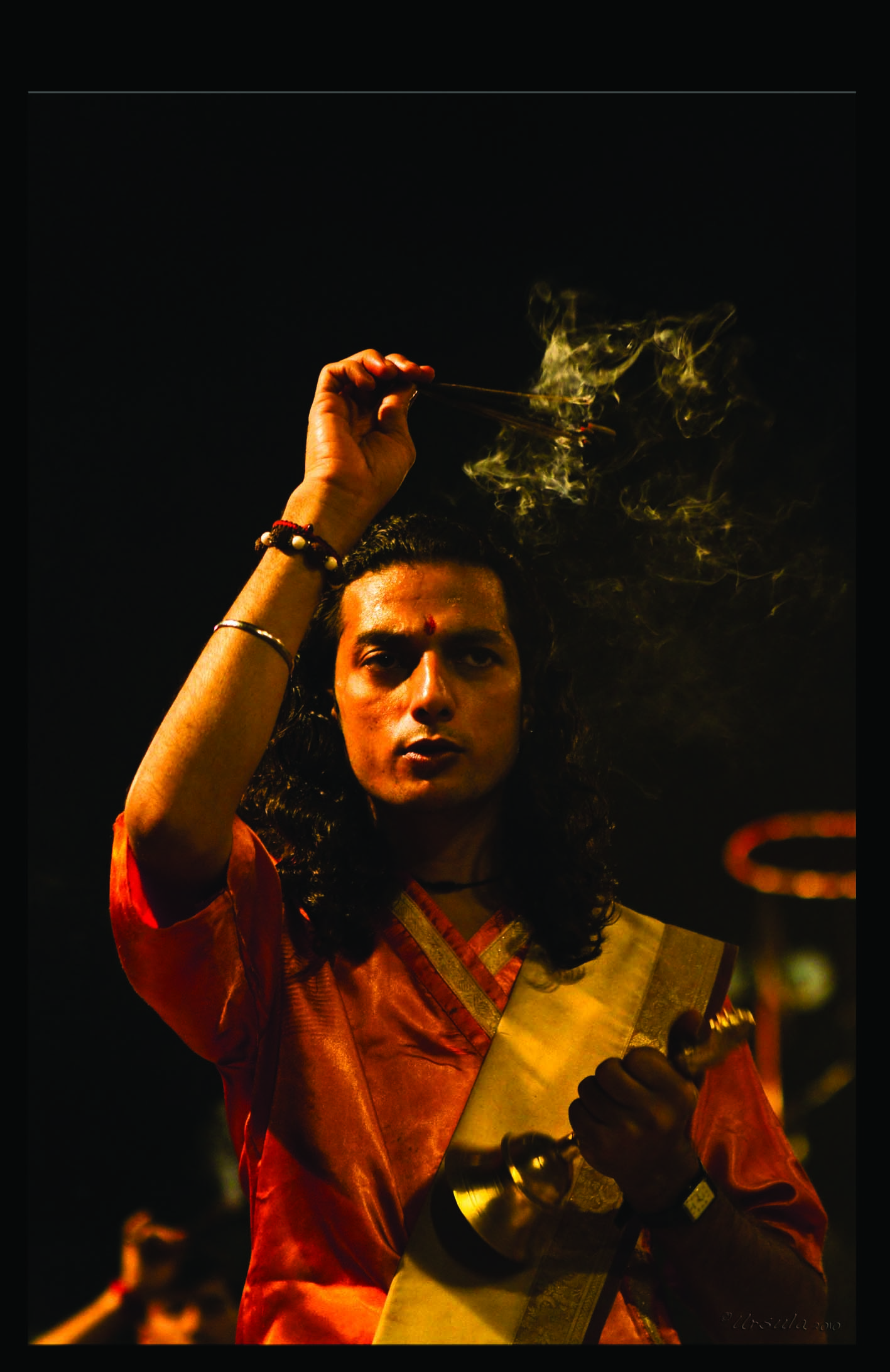
- Performing the Ganga Aarti from Dasaswamedh Ghat, Varanasi
- Buddha Head from Shwedagon Pagoda, Myanmar
- Harry Clarke Window from Dingle, Ireland
- Novice Monk Shwe Yan Pyay Monastery, Myanmar
Packets of 10 for $AU50.
Or - pick any photo from my Flickr or Wanders blog photos.

.jpg)
.jpg)
.jpg)

 One day …




 locked-down world, I hope you have some natural beauty to comfort you, and blue skies overhead.





 I think we were all winners.