The seaside city of Exmouth is at the westernmost gateway to The Coast. From nearby Orcombe Point, you can join the South West Coast Path and walk along the top of the cliffs.
Much as I know I would love the walk, we ran out of time on our visit to Devon this past Northern summer. We did, however, enjoy a boat trip from Exmouth (Stuart Line Cruises) along some of this magnificent, predominantly undeveloped, coastline.
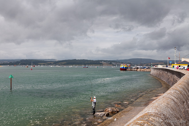
Fisherman at the Seawall The skies are overcast as we make our way along the Exmouth Seawall to the boat dock in the distance.
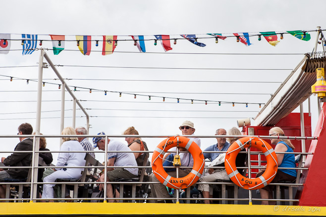
Stuart Line Cruises Passengers are already seated on the upper deck of the Pride of Exmouth when we arrive.
Orcombe Point The clouds lift, the sky turns blue, and we watch as Orcombe Point, the official start of the Jurassic Coast, comes closer.
Geoneedle on Orcombe Point It is almost impossible to see at this distance, but high on the cliffs is a pyramidal “Geoneedle”. Designed by sculptor Michael Fairfax, the work – which marks the start of the Devon Heritage Coast – is constructed from the different stones that make up the region.The lines in the cliff-face, dipping to the east, clearly show the tilt in the landmass. In general, Great Britain is rising up in the north and sinking in the south. The Jurassic Coast tilts slightly to the east, so erosion has exposed the oldest rocks here at Orcombe Point, and progressively younger cliffs towards Dorset.
Triassic Coast The rocky cliffs around Exmouth are a magnificent red: desert sandstone from the Triassic period, 250-200 million years ago.
Triassic Cliffs ~ Straight Point A line of guano contrasts dramatically with the rough, eroded cliffs at the east end of Sandy Bay.
Cormorants Oblivious to our passing, waterbirds sit on the bluffs, watching out to sea.
Flags Flying ~ Straight Point Once we round the point, the flags go up on the Royal Marine Shooting Range, indicating that the firing range is now in use.
Cottages on the Top The cottages of Devon Cliffs Holiday Park cling to the top of the cliffs; greenery clings to the sides.
Otter Cove The 245 million-year-old red mudstone and sandstone cliffs around Otter Cove are ridged and pockmarked.
Bath Houses Towards the east end of the pebble beach around Otter Cove, we come to the small coastal town of Budleigh Salterton.
Apartments and Bath Houses The waters around Budleigh Salterton are sheltered, and water sports are clearly popular.
The Bluff Bounded on the east by the mouth of the Otter River, the estuary near Budleigh Salterton is a haven for migratory birds
Fog on the Bluffs As we continue east, fog rolls in …
Fog … enveloping the cliffs around Ladram Bay.
Ladram Bay Ladram Bay is home to one of England’s largest holiday parks.
Our Skipper Wisps of fog wind around us and the sandstone rock stacks as our skipper guides us into Ladram Bay.
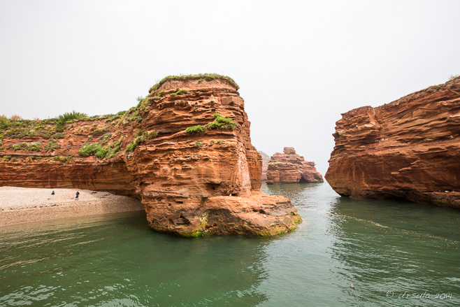
Rock Stacks in Ladram Bay Red from the iron oxide in the triassic “Otter Sandstone”, erosion has worked its wonders on the vertical fractures and joints in the earth’s layers to produce these sea stacks. We were reminded of our visit to the “Twelve Apostles” in southern Australia earlier in the year.
Ladram Bay Beach and Rock Stacks These ancient rocky stacks and cliffs are the richest source of Triassic reptile fossil remains in Britain.
The Coast Fog curls out behind us as we turn around and work our way back along the coast.
Sea Kayaks A pair of sea kayaks bob around on the waters – insignificant against the expanse of the English Channel.
Exmouth Waterfront Too soon we are back at Exmouth’s seawall and the candy-coloured houses lining The Esplanade along the waterfront.
Exmouth Pier
Mouth of the River Ex Walking up the hill to our accommodation, we watch the boats head back out on a changing tide.
Pergola on the Point A delicate pergola on one of the many rocky points on Gulangyu Island allows views (albeit foggy) of Xiamen across the water.
Gulangyu. “Drum Wave Islet”.
Named for the sound that the waves make as they roll off the Taiwan Strait and hit the off-shore reefs and rocks, Gulangyu Island is a delightful place. Just a short ferry ride from downtown Xiamen, in the south east of the People’s Republic of China, it is a popular destination for local visitors.
Gulangyu’s charming pedestrian-only streets are filled with traditional Chinese buildings and gardens, intermingled with Victorian-era European architecture dating back to colonial days. Following China’s loss in the First Opium War (1839–42), Xiamen became one of five treaty ports established under the 1842 Treaty of Nanking. Rich overseas Chinese and foreign nationalsfrom 13 countries – including Great Britain, France and Japan – built mansions, churches, consulates, and public buildings on Gulangyu, which was officially designated an International Settlement in 1903.
The island is only 1.78 square kilometres in size, so it is easy to get around the maze of lanes and walkways. But there are plenty of things to see and do: locally renowned for it’s natural beauty, it also has numerous museums and other attractions. We bought the combined ferry + 10 attractions ticket for ¥100 (less the $20) and did our best to visit as much as we could…
Gulangyu Island It is a hazy day, and the view from the moving taxi across the waters of Xiamen Port to Gulangyu Island is murky.
Gulangyu Island Map In theory, it is a short hop from Xiamen to Gulangyu. In practice, the island is extremely popular with local visitors. When we arrived at the ferry terminal, there were crowds of people queued in numerous lines everywhere. Very little signage was in English and it took us a while to work out which line we belonged in!
Ferry Xiamen Port is a busy waterway, with a number of different working wharfs along the waterfront.
Passenger Cruise Boat Some boats offer scenic cruises around the islands.
The Masses The herding of people on and off the ferries is actually quite quick and efficient.
Boat Dock Xiamen is an important business hub, as can be seen by the glossy, modern buildings in the misty distance.
Leather Elephant Art You could spend all day wandering around the numerous arts and crafts shops.
Rock Formations The locals come to explore the rocks on the foreshore …
Sand Play … or to play in the sand with new buckets and spades bought from the hawkers nearby.
Young Women on the Rocks Posing for pictures is always part of a day out with friends.
Artists at Work
Fuding Rock A statue of Zheng Chenggong, or Koxinga, a Chinese military leader of Ming forces who defended against the Manchu conquerors in the 1650s, stands high on Fuding Rock.
General Zheng Chenggong The giant statue is 15.7 meters tall and weighs in at 1400 tons. The general drove the Dutch out of Taiwan in the 1660s, and so is a hero to the people there as well.
Zheng Chenggong This tribute was carved from 625 pieces of white granite quarried from Zheng Chenggong’s hometown of nearby Quanzhou.
The Poems of Zheng Chenggong The General’s poems are represented in beautiful calligraphy in celebratory gardens.
“Driving away the Invaders” Zheng Chenggong’s victories are memorialised in sculptures around the gardens.
Cooking Squid Locals consider the food on Gulangyu pretty special. A woman in a stall on “Food Street” prepares seafood to order.
Lunch Menu We found a sheltered restaurant out of the midday heat. The pictures on the tablecloths allowed us to order our food with some confidence.
Sayings of Dr Lin Qiaozhi The island has been home to some famous people. Dr Lin Qiaozhi, pre-eminent pioneering doctor of gynecology and obstetrics, was born here. Quotes from her writings surround the house that is now a museum in tribute.
Dr Lin Qiaozhi Linqiaozhi The pictures, clippings and memorabilia in the Memorial Hall tell the story of a remarkable woman. She trained in Beijing, England and the US, and revolutionized modern Chinese gynecology and oncology.
Shuzhuang Garden The island may be small, but there are miles of walkways meandering through the gardens and over the water. Shuzhuang Garden was originally built in 1931 as a private villa, but was opened to the public in 1955. It is divided into two parts: the Garden of Hiding the Sea(Canghaiyuan)(pictured) and the Garden of Making-Up Hills(Bushanyuan).
Piano Museum There are several exhibits and museums on the island, with two dedicated to musical instruments: Gulangyu Organ Museum, and this one filled with pianos, including rare examples from the 1800s. There are said to be over 200 pianos on what the locals call “The Island of Music”.
Entry to Sunlight Rock A family sits for their photo before climbing up to Sunlight Rock, the highest point on the island.
“Crag of Sunlight” In the heat of the day, it is a hard climb up the steps …
The Peak … to the 92.7 metre summit of Sunlight Rock, …
View over Gulangyu … but the 360º views over the island – and beyond – are worth it.
Architecture Some of the old buildings along the narrow streets are empty shells – others are renovated as shops, housing, and restaurants.
Boats on the Crossing In the afternoon, the waters of Xiamen Port are still busy …
The Ferry Home … as we make our way back to Xiamen.
It was a full day – and there was still much more we could have seen and done. If I had the chance to go back, I’d do what one TripAdvisor reviewer suggested, and stay overnight – enjoying the peace of the evening after the day-trippers have gone home.
Sailing West Another perfect day of sun, breeze, and salt water, on British Columbia’s Georgia Strait. (06August2012)
“The cure for anything is saltwater – sweat, tears, or the sea.”
– Isak Dinesen
“… sweat, tears, or the sea.” Sailing provides all three.
I love being on the water. And – even with the sweat, tears, and frustrations – being on the water under sail is even better.
I’m not a particularly good sailor. That is in no small part because I don’t get onto the water often enough. Sorting back through photo-files on external drives reminded me that it has been two years since my husband and I were last out on Graystone, an old 38-foot Hughes sloop that berths in Nanaimo, BC.
Nanaimo sits on the east coast of Vancouver Island: almost due west across the busy Georgia Strait from Vancouver, and an easy northwest sail to the Sechelt Peninsula and its “Sunshine Coast” (see also: “Messing About in Boats”).
We were thrilled to get some fair winds on our last trip out into the bays, across the straits and through the BC waterways.
Summer Colours A lime-green boat tied up at Stones Marina contrasts with the green trees of Newcastle Island in the background. (31Juy2012)
Harbour Air DHC-3 Incoming! Newcastle Island Passage between Nanaimo and nearby Newcastle Island is a busy place, with boats and seaplanes coming and going all the time. (01August2012)
Dragon-Boat Bras Every year, Newcastle Island Passage is home to a Dragonboat Festival. A local group of breast-cancer survivors are regular winners, and have a celebratory “totem” in the middle of the channel. (01September2012)
Snake Island There are plenty of obstacles to avoid as you make your way through Departure Bay. (03August2012)
Sheets and Tackle The sails are up, – (03August2012)
Sails and Rails – the wind catches, and the sun shines. Perfect weather! (30August2012)
Entrance Island Entrance Island has a manned light station – and is a popular spot for harbour seals and Steller’s sea lions. (31August2012)
The Sunshine Coast Across the Georgia Strait, the mainland comes into view. (03August2012)
Sloop and Dinghy We are not the only sailboat making our way across the Malaspina Strait at the north end of the Sechelt Peninsula. (04August2012)
Ketch A double-masted schooner takes advantage of the steady breeze coming into Pender Harbour. (04August2012)
Motor Boat Because of the bays and coves in the area, Pender Harbour has over sixty kilometres of shoreline and is a haven for summer cottages and boats. (04August2012)
Full Sail on Pender Harbour (04August2012)
Thistle One of the pleasures of sailing, for me, is coming ashore in new locations. This was our first stop at the Government Wharf on Pender Harbour: in the charming community of Madeira Park. (04August2012)
“Do Not Trespass” It shouldn’t need to be said, should it? (04August2012)
Totem Pole Madeira Park is part of what was Coast Salish Indian territory – although very few remain in the area. (04August2012)
Crab Buckets Boats of all kinds dock on the Government wharf. (04August2012)
Selling Crabs Fishing boats mean fresh, straight-from-the-ocean, seafood. (04August2012)
Sea Plane A Beaver DHC-2 stops at the wharf to drop off passengers. (04August2012)
Ruby Lake As evening approaches, we head out to one of our favourite restaurants – just a short drive away from the wharf – on the beautiful Ruby Lake. (04August2012)
Malaspina Strait There is still snow on the distant mountains as we take the boat out for another beautiful day on the waters. (05August2012)
Canadian Flag The flag whips out behind us as we race west across the Georgia Strait back to Nanaimo. (06August2012)
East Cardinal Marker The marker buoy signals our return to Departure Bay. (06August2012)
Gull with a Starfish A seagull enjoys part of a starfish as we tie up the boat. (06August2012)
Nightfall It’s beautifully quiet on the marina. Now that we are safely moored at “home”, we share a glass of wine as the sun goes down. (31August2012)
We had it easy: our saltwater included no tears: only sun and sweat, good winds and calm seas. A cure for anything indeed.
[…] had already been out sailing several days on Graystone, a comfortable 38-foot Hughes (On the Straits and Narrows (Part 1)), so we had our sea legs. Even so, traversing the 60-metre-wide Dodd Narrows had me nervous. Timing […]ReplyCancel
Masjid-i Jahān-Numā ~ Jama Mosque Jama Masjid, the best-known mosque in India, is a pilgrimage site for Indian Muslims, and a stop for most visitors to Delhi. (04November 2013)
The Masjid-i Jahān-Numā (the “World Reflecting Mosque”), situated in the heart of Old Delhi, is the largest and most important mosque in India.
The Dome of Jama Mosque ~ from the crowded streets of Old Delhi.(12April2008)
Three long sets of red sandstone steps lead up to the three large entry gates on the east, north and south of a massive courtyard. The courtyard itself, which holds up to 25,000 people, is surrounded by open arched colonnades on three sides, and the west-facing three-domed mosque flanked by two impressive 40-meter high minarets on the fourth.
More commonly known as Jāma Masjid: for Jummah, the weekly Friday noon gathering for Muslim prayers + Masjid, “congregational mosque”, Jama Mosque is a central feature of many tourist visits to Delhi.
Steps to the Main Gate ~ North Gate The main entry to the mosque is high above street level. (08April2010)
Child on the Steps The wide front steps to the mosque make a good resting place. (04November 2013)
Gate Keepers Before entering the mosque, visitors need to be shoeless and properly covered. For a fee, shoes can be left with the workers at the gate… (08April2010)
Tourists in the Heat Haze … and voluminous, garishly-coloured cover-alls can be rented. (04November 2013)
Jama Masjid The large inner courtyard of the mosque has ample room for tourists, pilgrims and large prayer gatherings. (04November 2013)
Dome The three domes are built of alternating stripes of black and white marble, which contrast with the gold at the point, and the red sandstone of the walls. (04November 2013)
In the Corridors Corridors run around parts of the courtyard … (04November 2013)
In the Corridors … giving people shelter from the sun, to rest or sleep. (12April2008)
Man in an Alcove All around the compound, people find corners to sit. (04November 2013)
Around the Reflecting Pond In the centre of the courtyard is a large square pond. (04November 2013)
Reflecting Pond The water in the pool is greenish with a scum layer on top and pigeon feathers floating in it… (08April2010)
Three Women (08April2010)
On the Reflecting Pond …but the faithful are happy to wash their hands, face, feet, and hair in it. Some even brush their teeth. (04November 2013)
Shooting Me Of course, if you are taking pictures, you, too, are fair game! (08April2010)
Kids Posing If you have a camera, the children will come, looking to have their pictures taken. (04November 2013)
The Mosque Entrance It is a short climb up from the courtyard to the mosque. (04November 2013)
Writing on the Wall The white marble walls are graced with inlaid black inscriptions. (12April2008)
Seated Man (04November 2013)
Contemplation All around the mosque, people sit in corners… (08April2010)
Interior Arches … in prayer or contemplation. (08April2010)
Changing the Lights A worker on a long ladder changes bulbs high overhead. (08April2010)
Turrets and Arches The architecture is beautiful and delicate. (12April2008)
Mother and Daughter (08April2010)
Iconography Back outside the mosque, icons and religious paraphernalia are amongst the things on sale. (08April2010)
I have visited Jama Masjid on a number of occasions, and each time has had its own rewards. The beauty of the buildings endures, but the shades of colour in the red sandstone are always different with the changing light. There are always pilgrims and visitors adding vivid splashes to the scene: they are always interesting to talk to and many are willing to be photographed.
Tourists are not allowed entrance to the mosque during prayer times, which is just as well: I wouldn’t like to compete with 25,000 faithful!
Until next time ~ Namaste!
Pictures: 12April2008, 08April2010 and 04November 2013
[…] – masjed or masjid – are a prominent feature in any Islamic landscape (eg.: Jama Mosque). With their beautiful domes, their graceful arches, and their soaring minarets, these houses of […]ReplyCancel
Eastern Grey Kangaroo – Macropus Giganteus In the grassy flats north of Haycock Point, a male grey looks around, showing off his powerful shoulders.
I am a stranger to my own neighbourhood.
Since “repatriating” to Australia from Asia almost three years ago, my husband and I seem to have spent very little time in the country. And, as our family and friends live a long way from our home, much of the time we do spend in the country is spent in the car, in hotels, and/or in other people’s homes.
As much as I love walking, during those brief intervals when I am at home, I get caught up in the day-to-day, or spend my time sitting on my balcony watching the birds on the estuary. I don’t get out to explore nearly often enough.
So, it is a real treat when one of our short home-stays coincides with a good excuse to go for a ramble around our little corner of the world. The local National Parks Association chapter only facilitates regional walks every two months, but last May the dates lined up for us and we joined a small group of hikers in the north end of Boyd National Park, NSW for the easy 6km return walk from Haycock Point to Barmouth Beach.
Beach at Haycock Point Overcast skies greet us at the beach off the Haycock Point picnic area as we wait to start our walk.
Rocky Red The rugged coastline of folded Devonian strata at Haycock Point juts into the Tasman Sea.
Cormorants Birds sit on the rocks, red with iron, and watch the water.
Scarlet Robin Keep your eyes sharp!
Scarlet Robin The local birds can be hard to spot in the native bush.
Waters off Haycock Point A small patch of blue appears in the waters off the cliff. Maybe the skies are lifting?
North to Barmouth Beach The walkers head north, into the scrubby woodland leading away from Haycock Point.
Gumnut Flowers The woollybutt (eucalyptus longifolia) trees are in bloom around us.
Not-So-Delicate Bush Clumps of delicate-looking drooping she-oak (Allocasuarina verticillata) bushes sit on the wind-swept grassy plains.
Red Rocks As the track rejoins the coast, we get another view of the red rocks to the south…
Arched Rock … and of an unnamed rock arch to the north.
Wild Berries The Australian mock orange trees (Pittosporum undulatum) are heavy with small fruit.
Barmouth Beach The beach at the mouth of the Pambula River comes into view through the trees.
On the Water Kayakers take advantage of the calm, if overcast, conditions.
Red Rocks on Barmouth Beach Iron-rich rocks resist the erosion that has carved out this dramatic shoreline.
Sand and Rocks on Barmouth Beach
The Brightness of Water Waves splash against the rocks on the shore as we eat our lunch on Barmouth Beach, the end-point of our walk.
Barmouth Beach George Bass, British naval surgeon and explorer of Australia, first landed at Barmouth Beach in December 1797 to shelter from a gale.
Colours of Barmouth Beach According to the NSW National Parks Service,George Bass“marvelled” at the beauty of this area as he explored up into the Pambula River.
Pambula Across the Water As we work our way back from Barmouth Beach, the sun breaks through the clouds.
Swamp Harrier We thought this was a sea eagle, as we watched it and its mate high in the treetops – but I’m pretty sure its another raptor: a swamp harrier (Circus approximates).
Eastern Grey With effortless grace, a kangaroo we startled bounded off across a grassy flat.
Eastern Greys Two other roos keep a watchful eye on us.
Watchful Wallaby In a near by grassy patch, a swamp wallaby (wallabia bicolor) grazes.
Haystack Rock The wreck of the SS Empire Gladstone sits under the waters here. It struck rocks and sank in 1950 after mistaking the lights of the nearby town of Merimbula for a lighthouse.
Coastal Banksia – Banksia Integrifolia Tangled banksia greets us as we reach the car park near the Haycock Point picnic area…
Kookaburras – Dacelo … and kookaburras laugh overhead as we enjoy our post-walk coffee.
All in all, a pretty typical day in the Aussie bush.
Thanks for the wonderful pics – I missed the walk but now feel that I have seen the highlights! The “not so delicate bush” is Allocasuarina verticillata and the flowering gum is Eucalyptus longifolia
[…] done this walk before (see: In the Aussie Bush), but what amazes me when I looked back over the pictures from both visits, is how many differences […]ReplyCancel
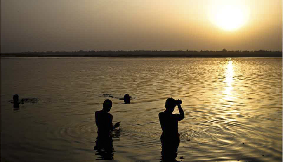
- Performing the Ganga Aarti from Dasaswamedh Ghat, Varanasi
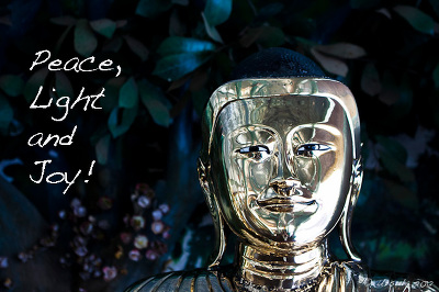
- Buddha Head from Shwedagon Pagoda, Myanmar
- Harry Clarke Window from Dingle, Ireland
- Novice Monk Shwe Yan Pyay Monastery, Myanmar
Packets of 10 for $AU50.
Or - pick any photo from my Flickr or Wanders blog photos.


 We’re heading back next summer, when we can (hopefully) visit a bit more of this dramatic coastline.




 It was a full day – and there was still much more we could have seen and done. If I had the chance to go back, I’d do what