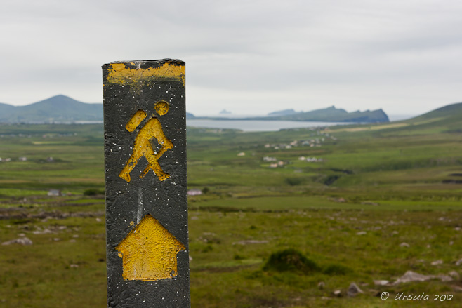
 Follow the Walking Man
On Mt Brandon, looking back over the magnificent Smerwick Harbour, Ireland. If you are a regular visitor to this site, you’ll know that I love walking.
The thing is: some days I enjoy it more in retrospect than in real time!
By Day 8 of our walk around the Dingle Peninsula, that was certainly the case. I was tired.
We’d lost the trail on a bog-covered mountain the day before, and doses of anti-inflammatory drugs overnight had not met the challenge of ageing knees and hip joints. Tired and sore.
Then there was the intermittent rain: just enough so that we had to pull the raincoats out of bags at least once a day; just enough to ensure it was always slippery under foot. Tired and sore and wet.
According to our notes, we had another mountain to cross…
Day 8: Ballydavid to Cloghane
This is one of the most remote sections of the Dingle Way; offering you a combination of history and breathtaking scenery.
The trail follows a green road that crosses the shoulder of one of Ireland’s highest mountains “Mount Brandon” standing at 952Mtrs. Passes a standing stone that dates back over 3.500 years; which still displays the symbols of Ogham Writing. Crosses over an area of blanket bog where turf is still harvested in the traditional ways of our forefathers.
Finishing in the quiet village of Cloghane; that lies in the shadow of Mount Brandon.
Distance: 19 km/13 miles, Ascent: 670 m/2010 ft
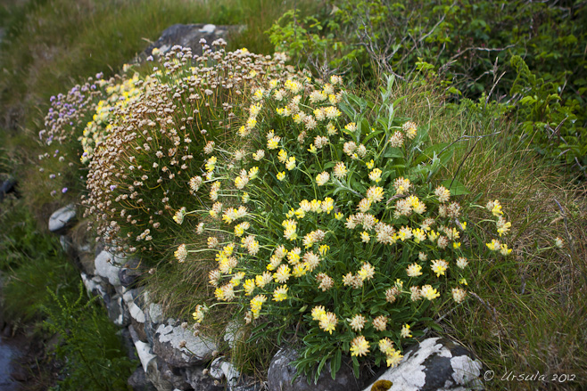 Flower Border
Flowers in the village send us off on our way… 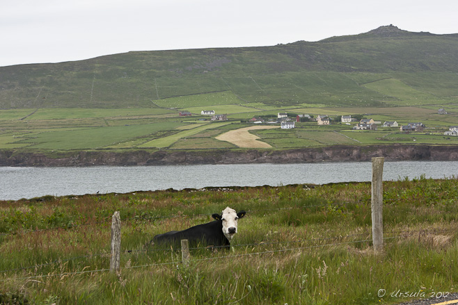 Cow in the Countryside
We had a fair walk along country roads before heading off cross-country.  Still Waters
Quiet waters and a dotting of farms under lowering skies. Currach or Naomhóg
The Blasket islanders developed a distinctive regional type of currach (or naomhóg) which they used for transport and fishing. Creek Waters Barbed Wire
Sheep’s wool, stone fence and a green mountain; it doesn’t get more Irish than that. Irish Sheep
The sheep are curious about out our progress. Wild Honeysuckle
Like the Irish spirit, the delicate honeysuckle (Woodbine: Lonicera periclymenum) is flexible, resilient, and deceptively strong. From Mount Brandon
In spite of low cloud, we still have magnificent views back over Ballydavid Head and the Three Sisters. Ogham Stone
This Ogham, dating back to the 4th Century, apparently says: “Ronan, the priest son of Comgan”. We were really excited to reach the Ogham Stone in the saddle between Masatiompan and Mount Brandon: according too our trip notes, there were a number of Ogham stones along our walk, but so far we had not succeeded in seeing any of them. We had looked – but the notes were often a bit vague, so we weren’t sure if we were looking in the wrong place or for the wrong thing. We were beginning to wonder if the stones had all been carried away by archaeologists or leprechauns. This was our first!
Reaching the stone also meant we had reached the high point of our day, and the rest should be down hill. Easy, right?
Wrong! More of a water-runoff-gully than a path, the way down the mountain was steep, mired in mud and water, and frequently slippery. Burdened as we were with day-packs and camera gear, we picked our way down as carefully as we could, grateful for our trusty walking sticks. It took us more than an hour to reach the peat road part way down the hill. By this time, I was ready for the day to be over, but we still had at least eight kilometres to go… I took some comfort in the fact that three young walkers we had passed along the way were still well behind us, so it wasn’t just age that had slowed us down: it truly was a wicked stretch of ground!
Brandon Point
View over the flank of Masatiompan towards Brandon Point. This Way Down
Steeper than it looks, muddy and wet; we were pleased we had our walking sticks. A Cairn along the Way
Previous walkers have marked their passing along the “trail”. Stones along the Path
At this point, the trail became a little drier and more manageable. There’s a walking man ahead! Peat Gathering
Blanket peat covers most of the Dingle Peninsula. Although it is considered a non-renewable and not-particularly efficient energy source, it is harvested by locals for burning as fuel and for sale. Teer Bog Road
A peat-cutter’s road leads down towards Brandon Bay. Another Lamb… Brandon Bay
Cottages come into view; dinner can’t be too far away! More Cows… Brandon Bay
Finally! We are back at sea-level, as the clouds lower over the bay. Fishing Boats
Small craft are tied up at Brandon Pier. Last Light
Rain clouds hover over the beach at Brandon Bay as we make our way to our lodgings near Cloghane. As we sat in the pub in Brandon over a glass of wine and a fabulous hot meal, the wet, the pain, and the tired were forgotten – almost. It was a beautiful walk and I’d do it again…
Well, maybe on a dry day.
Sláinte!
Pictures: 26June2012
Posted in Ireland,Landscapes,Nature,TravelTags: blog,boats,Dingle Peninsula,Ireland,nature,Photo Blog,rural,The Dingle Way,travel,Travel Blog,Ursula Wall,walk
The Pinnacles
The white sands and red clay cliffs make a striking contrast to green eucalyptus, blue skies and water. We live in a glorious corner of the universe, with National Parks, beaches, wetlands and mountains virtually at our doorstep. Trouble is, we are on the road so much that sometimes we forget to get out and explore when we are at home. That’s where having visitors comes in handy: there is no better way to appreciate your own neighbourhood than by showing it off to someone else!
It’s only a short drive from our little “Eden” to the northern half of Ben Boyd National Park – even so, we’d not been there before taking visitors to have a look last February.
The Walking Track
It’s an easy one kilometre circuit out to the Pinnacles and back to the car-park. The Path
A short rise leads us up through the banksia trees. Drying Banksia Flowers (Proteaceae)
Soon they will lose their characteristic flower spikes, and the gnarly “cones” will be visible. Saw Banksia or Old Man Banksia (Banksia Serrata)
I can’t see these gnarled trees without thinking of the Australian children’s writer, May Gibbs… May Gibbs
“Gumnut babies” are the flower/seed pods of the Eucalyptus (https://www.kopida.com/2011/12/may-gibbs.html) May Gibbs
“The Banksia Men Make a Wicked Plot”
(https://thinkdesignerprints.com.au/australiana/) Banksia Branch
Not quite “bad banksia men” yet, but these seed pods are browning. Long Beach
It looked like a beautiful afternoon on the beach. Usually you can walk down and view the Pinnacles from their base, but the steps were closed when we visited. The Pinnacles
The coloured cliffs of the Pinnacles come into view through Banksia branches. More Banksia
Trees line the sandy path around the point. The Pinnacles
The white sand and red clay cliffs of the Pinnacles were laid down over 30 million years ago. Leaf Litter and Seed Pods Termite Mound
The vegetation changes dramatically on the second half of the path, with tall trees and termite mounds. We even spotted two black cockatoo overhead! They were too fast for my camera. The short hike around the Pinnacles left us with time and energy to spare, especially as we couldn’t walk down to Long Beach. Just a ten minute drive up the road is Panboola, a protected wetlands, supported by National Parks and local agencies and industries, situated on 77 hectares (190 acres) of reclaimed farmland, town-land and a horse-racetrack.
It was late afternoon: a perfect time for a stroll.
Entry to Panboola
We parked close to the entry and wandered some of the pathways around the 77ha (190 acre) wetlands. Egret
From a covered pavilion near the entry, we learned about the reserve, and watched local waterbirds. Purple Wildflowers Picnic Table
There are places to sit, if you have time. Purple Swamphens (Porphyrio porphyrio) A Holstein
Areas within the wetland are still used as farmland. Old Stables
Buildings from the abandoned racecourse sit around the track. Old Grandstand Eastern Grey Kangaroos (Macropus giganteus)
Early morning and late afternoon are the best times to meet Australian wildlife. These kangaroos were the biggest I’ve come across. Two more eastern grey kangaroos watch us from a safe distance… … before bounding off into the scrub.  It is amazing what you find on your own doorstep! It is amazing what you find on your own doorstep!
Sometimes we forget that the “familiar” to us is “exotic” to someone else.
And, our own neighbourhoods are always worth exploring.
Happy rambles!
Pictures: 07February2013
Posted in Australia,Nature,TravelTags: Ben Boyd National Park,blog,National Park,nature,Panboola,Photo Blog,travel,Travel Blog,Ursula Wall,walk,wetlands,woods
Guinness Black Ale
Ready for drinking at the Gravity Bar, top floor of the Guinness Storehouse, Dublin (iPhone S4). It was St Patrick’s Day this week, so it seemed fitting to return to another Irish cultural icon: Guinness.
July last year was wet in Ireland, and it rained much of the short time we were in Dublin. So, we visited the Guinness Storehouse: it was a good way to learn something about local history, while staying dry for a few hours.
As a bonus, we each got a “pint of black” with our entry price.
Sir Benjamen Lee Guinness (1798 – 1868)
The grandson of Arthur Guinness (founder of the Guinness brewery) has his statue in front of St. Patrick’s Cathedral, which his funding helped restore. The Guinness dynasty has left an indelible mark on Dublin. Our open-bus tour took us past the house in which Arthur Guinness (1724/1725 – 1803), lived. Billed as an entrepreneur, visionary and philanthropist, in 1759 Arthur founded the now-famous brewery at St James’s Gate. An Irish Protestant, Guinness was deeply influenced by John Wesley’s theology of social ministry. He started (and funded) the first Sunday schools in Ireland; he gave vast amounts of money to hospitals and charitable projects for the poor; and he payed his workers about 20 percent more than other employers. More importantly, he passed his reformist ideology down to his heirs: “If you had worked for Guinness in 1928, a year before the Great Depression, you would have had 24-hour medical care, 24-hour dental care, on-site massage therapy.”
Over the generations, the Guinness family has been responsible for (among other things) funding parks and medical facilities, as well as restoring St. Patrick’s Cathedral and other public properties.
Guinness Storehouse
Entry to the original St. James’s Gate brewery, established in 1759. The original brewery at St James’s Gate is the centrepiece of the Guinness story. Inside the thick brick walls, what was once the old brewery and storehouse is now a museum built in girders and glass. Rising up the centre of the seven-story building is the world’s largest pint glass. At the base of the glass is a special document: the original 9000-year lease for the St James’s Gate property.
The Lease
The original 9000-year lease for the St James’s Gate Brewery is part of Guinness mythology; harder to track is the real story of expansion (from 4 to 50 acres) and changes of ownership over recent years. The Collection
Making a point for the breadth of Guinness history, the bottle case reminds us about the role of legal documents and developments in transportation in the Guinness story. A Guinness Guide
Before we are let loose on the several floors of audio-visual displays, we are given a brief talk. Bolts
Dim lighting and “industrial” architecture foster the image of a once-working brewery. Hops
The brewing story starts with four natural ingredients: yeast, barley, hops… Fresh Water
… and water – lots of water. Audio Visual
A combination of displays, old machinery. and explanatory posters walk you through the process. Old Machinery Explanations on Glass A Copper Kettle Looking Down
As we work our way up the “pint glass”, we can look back down over the ground-floor retail space. Industrial Pipes Machinery ~ Abstract Colour As well as explaining the brewing process, the museum looks at distribution and transportation. My great-grandfather was a cooper, so I was particularly interested in watching the short film about the Guinness Master Cooper, Dick Flanagan, making barrels.
The Coopers’ Barrels
An old film demonstrates the skill of the coopers who make the wooden barrels. Coopers’ Tools Labels over Time A large section of the museum displays sponsorship and advertising over the years. Who can forget “I like to watch” or other famous Guinness ads from years gone by? There are also sections on health and responsible drinking, tracing family who might have worked for the company, and even cooking with Guinness.
In keeping with the mythology of the perfect beer, there is an entire section instructing you how to pour a pint: a six-step process, achieved in two stages and taking exactly 119.5 seconds!
Part-pints, ready to be topped up. Guinness Baristas? Glass Bricks
The canteen on the sixth floor is empty as we work our way up the building. The Perfect Pour?
“Good things come to those who wait.” The Gravity Bar
On the top floor of the Storehouse, there is plenty of space to enjoy the views over Dublin. Pony Trap
Wet Dublin streets.
I confess: I don’t actually like Guinness, or any other beer.
I did my best to down my pint: I managed a quarter and gave the rest to my husband.
Outside it was still wet. Oh well – that’s Ireland.
Happy St Patrick’s Day ~ Sláinte!
Photos: 07July2012
Posted in Ireland,Museum,Travel,WorkTags: Guinness Storehouse,machinery,museum,people,Photo Blog,portrait,travel,Travel Blog,Ursula Wall
Kayak at Rest
Roland Point, Skookumchuk Narrows, BC, Canada Skookumchuk.
Anyone who has had anything to do with boating or waters in the Pacific Northwest has heard of the legendary Sechelt Rapids at Skookumchuk Narrows. Boats, especially sail boats, need to pay careful attention to tide charts, and only attempt the narrow pass between Sechelt and Jervis Inlets at slack tide.
Spectators and kayakers, of course prefer their waters wild.
Skookum is “strong” or “powerful” in Chinook Jargon, the Amerind pidgin long used in the Pacific Northwest as a trade language. Chuck means water, so skookumchuck is literally “strong water”: “rapids” or “whitewater”. Like many other works from Chinook, the word is in common usage today in the English of British Columbia, and refers to the powerful tidal rapids at the mouths of most of the major coastal inlets.
The waters at Skookumchuk Narrows live up to their name: they are famous for their spectacular whirlpools and whitewater. “On a 3 metre tide, 200 billion gallons of water flow through the narrows” at speeds up to – and sometimes exceeding – 30km an hour. Depending on the height of the prevaling tides, there can be more than 2 metres drop in water level from one side of the rapids to the other.
I grew up hearing stories about the rapids and had always wanted to see them. Located on the north end of the Sechelt Peninsula, vehicle access is reliant on car ferries. We had a small window of opportunity last summer, on our way to the Earls Cove Ferry Terminal, just north of Egmont where the 4 km walking trail to the Narrows starts.
Trail to the Narrows
Most of the path through the tall Douglas Fir, Western Hemlock, and Western Red Cedar, is well maintained and easy walking. Secret Bay
We pass isolated Egmont homes and have a view down over the boats housed in the Bay before entering the Skookumchuk Narrows Provincial Park. Sword Fern (Polystichum munitum)
The temperate rainforest is rich with moss and ferns. Spanish Moss
According to one source, this moss lives on nutrients from dust particles and moisture in the air. Delicate Fungus
The dark, moist, forest floor plays host to all manner of vegetation. Almost Abstract
A view of Brown Lake, from behind a tangle of leaves. The Narrows
Although we have missed the strongest tide, we can hear the white waters before we can see them. Pine Needles Watching Water
Silhouetted behind trees, people watch the churning water. Sechelt Rapids
Kayakers paddle against Sechelt Rapids as we watch from North Point. Before the Change
Kayaks paddling into the eddies of a slowly-flooding tide. Solo Kayaker
Paddling hard against the current… Deceptive Calm
The silky waters almost hide the strong currents of the flood tide. Splash!
Thank heavens for waterproof jackets and the spraydeck (or “skirt”) that keeps the water from filling the kayak! Whitewater
Kayakers test themselves against the slowing flood tide over Sechelt Rapids. Riding The Tide
A lone kayaker rides through the tide change at Skookumchuck. The Tide
View from Roland Point. End of Day
As the light drops and the tide falls, the kayakers call it a day. Yellow Kayak The Path Out
Time to walk back through the hemlock, cedar and fir. Still Waters
The forest greens are reflected in the still waters of Brown Lake; stark contrast to the Rapids. Watching the kayakers paddling madly against the oncoming currents and tides rather made me wish I was a little better at it!
 Oh well. Oh well.
We settled for the brisk walk back to the car and a quick drive to the Earls Cove Ferry, where our water transport was much more sedate.
‘Till next time!
Pictures: 29July2012
Posted in Adventure,Canada,Landscapes,TravelTags: BC,blog,boats,Canada,nature,Photo Blog,Provincial Park,Skookumchuk Narrows,travel,Travel Blog,Ursula Wall,walk
Little Novice
Sitting on the banister: Shwenandaw Monastery, Mandalay Temples in Southeast Asia are living places.
This is certainly true in Myanmar. The many Buddhist temples I visited there were architecturally beautiful – and different, with no two exactly the same. But what I generally find more interesting is the life – both sacred and secular – within and around them.
On my first afternoon in Mandalay, I and the nine other photographic-tour participants, under the guidance of Photographer Karl Grobl and local guide MM, visited three distinctly different religious buildings.
Our first stop was the wooden Shwenandaw Kyaung or Golden Palace Monastery. Built in traditional Burmese style in the 19th century by King Mindon Min (reigned 1852-1878) as a palace, this graceful teak building is covered, inside and out, with carvings. Originally, these carvings were coated in gold (hence the name), but tropical weather has taken its toll: no gold remains on the outside, and many of the carvings are worn beyond recognition.
It is still an elegantly beautiful place – with a number of cheeky little imps running around in their novice robes, waiting to meet visitors.
On the Stairs
Shwenandaw Monastery Deva on the Door
Shwenandaw Kyaung Monastery is known for the magnificent teak carving adorning its doors and walls. Devas and Imps?
The very young novices are a contrast for the very old building. Shwenandaw Monastery Little Angels
I can’t help but wonder what their stories are. In Thailand, many young boys are enrolled in the local monastery, not because of any particular religious inclination, but because their families cannot afford to send them to school otherwise (e.g. Little Angels). Apparently, it is a similar story in Myanmar, so I was very curious about the young novices we met: what were their lives really like? The life of a novice is not easy, but perhaps it is easier than living in a poor rural household.
At the gates of the temple, it was getting busier, with people coming and going; many stopping in to the monastery grounds make offerings.
At the Gates
A woman pauses at the gates of Shwenandaw Monastery. Cycle Man
This man was waiting to chauffeur his friends home after their visit to Shwenandaw Monastery. Three Little Maids
I couldn’t help but think of The Mikado as I made this photo of three women giggling. Our second stop at The Kuthodaw Pagoda or Maha Lawka Marazein Paya (Royal Merit Pagoda) was a complete contrast. Although it was built during the same period, it served a very different purpose. King Mindon Min was concerned about the invading British and what their presence in Burma would mean for Buddhist teachings.
Saungdan (covered entry) to the World’s Largest Book
The Kuthodaw Pagoda or Maha Lawka Marazein Paya The Kuthodaw Pagoda is called the World’s Largest Book. King Mindon had the entire 15 books of the Tripitaka, the sacred scriptures of Theravada Buddhism, inscribed in gold on huge marble tablets. Each of these 729 double-sided slabs is housed in its own small stupa or kyauksa gu.
Pali Scripture
Each tablet is five feet tall and three-and-a-half feet wide; scribes took three days to write the words on both sides, then stonemasons chiselled 16 lines a day, before painters filled with the script with gold. Kyauksa Gu
Rows of stone-inscription caves, the white stupas housing the scriptures. Afternoon Storms
Weather threatens the domed stupas of Kuthodaw Pagoda. Lone Monk
… between the stupas of Kuthodaw Pagoda. Family Group
An extended family gathers in a sheltered hallway of Kuthodaw Pagoda. Auntie
Saungdan (covered hallway), Kuthodaw Pagoda Souvenir Seller
Tourists wanting a souvenir, or worshipers looking for an offering; someone will take care of you! Spire
A last look back at the sky over a Kuthodaw Pagoda stupa. It was getting dark as we arrived at our last temple-stop of the day, but fortunately the rains held off. We positioned ourselves on the upper balcony of a modest monastery, and waited as a young monk struck a metal bong repeatedly with a heavy wooden striker. Quietly, walking barefoot, maroon-robed monks emerged from all directions, and lined up to enter the prayer hall.
Strike the Gong
A call to evening prayers rings out across the monastery. Silent Prayers
Noiselessly, maroon-clad monks line up … Like Ghosts
… and silently enter the prayer hall. Evening Prayers
An hour of chanting in Pali before bed… … turns little imps … … into little angels.
I am seldom bored visiting temples: as I said before, architecturally, they are all very different.
And, they are busy places.
These pictures are just a sampling of the life within them.
Mettā!
Pictures: 13September2012
Posted in Architecture,Myanmar,Portraits,Religious PracticeTags: architecture,blog,buddhism,buddhist,burmese,children,environmental portrait,environmental portraits,Myanmar,people,Photo Blog,portrait,portraits,religion,Religious Practice,temple,travel,Travel Blog,Ursula Wall,worship
« Older posts
Newer posts »
|


")
